Spectacular cliffs, wild moors, a beautiful beach and curious seals will make this overnight hike one to remember. And if you need a bit of an extra challenge try to squeeze the three-day hike into two days. Legs of steel and a beautiful camp night with fantastic views on the most north-westerly point in mainland Britain will be your reward!
If Cape Wrath to you sounds just like something out of a Game-of-Thrones-episode or an Iron-Maiden-Song, welcome to the club. I have to admit one of the main reasons why I was interested in the hike to Cape Wrath was its name. Plus the fact that it is mainland Britain’s most north-westerly point. And supposedly spectacularly beautiful. The name Wrath, just to clear this up first, does not have anything to do with the English word wrath, but is derived from Old Norse hvarf which means “turning point”. It is believed that the vikings have used the cape as a navigation point, where they would turn their ships. Yet even “wrath” with its now common English meaning is a fitting place for this wild part of the Scottish coast.
The hike we undertook started from Blairmore Carpark and is advised to be done in three days. Due to a rather severe mistake in converting the miles to kilometers I thought we could easily do it in two days. We did do it, yet it was far from easy. If you do spread out the hike over three days as advised by for example the Lonely Planet guidebook it is a beautiful hike and one I well recommend. If you do it in two, I still recommend it, but be ready for some sore legs, if you are not a very well trained hiker.
We started off at Blairmore Carpark. The carpark has a public toilet and a tap with drinking water. We packed our packs with only the necessities, including a tent, sleeping bags, cooking gear, food, water, waterproof clothing and a basic first aid kit. Since we were only going to be gone for two days and didn’t bring a water filter, we planned to carry with us all the water we were gonna need, which was some 8 liters, counting on filling up some of the bottles at Cape Wrath, where we read there was going to be a little kiosk by the lighthouse. The big amount of water made the packs rather heavy, but the good news was of course they were only gonna get lighter as we marched on.
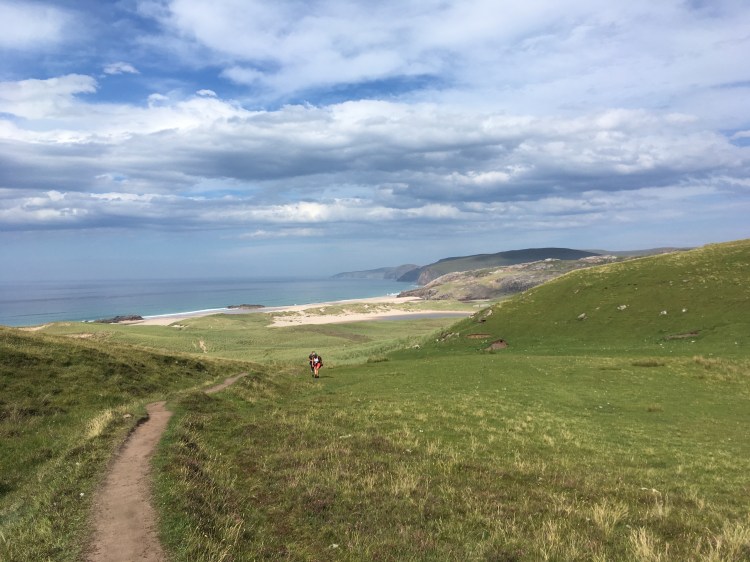
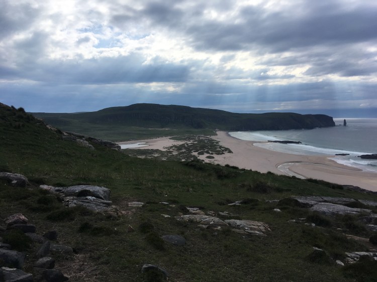
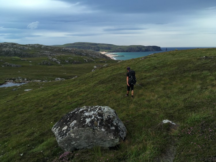
We set off along the well-maintained path to Sandwood beach and made good time there. The beach is as beautiful as it is described. Due to the comparably long hike in (7km one way), there were only a few people there. The beach spreads out wide, ideal for long walks – and surfing apparently as one local and his young daughter demonstrated. Sandwood beach is in itself a great destination and makes a nice and easy overnight hike, where you can camp hidden away in the dunes with the sound of the waves chanting you to sleep.

After a little snack we however decided to push on a little. We were not tired yet, and after all it was only 10 more kilometers, or so we still thought at that point.
Hiking got rougher after Sandwood Bay. There was no well-established path and you have to find your own way across the rocky and uneven terrain. Your best-practice will be to stay as close to the cliff as possible, since terrain gets more uneven and the ground more soggy the further you head inland. We did not know this and often chose to cut straight across the little hills instead of taking the seemingly longer route around the cliffs edge. Luckily we were smarter on the second day.
There are some rivers to cross, yet since they are shallow and there are many stones that can be used as natural bridges, this is not too difficult. As for the hiking on the grassy, rocky terrain: try to follow one of the many sheep-paths, since walking in this little pathways will let you save a lot of strength compared to walking cross-country through the grass.
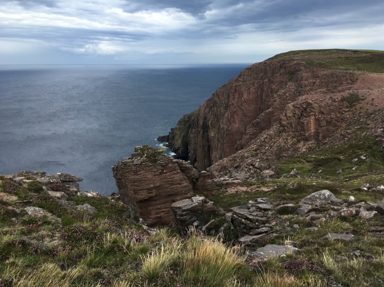
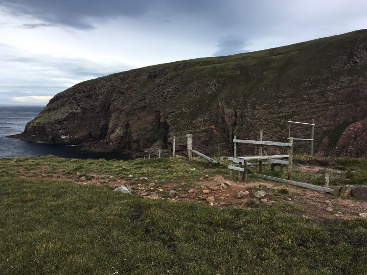
About half way in, you’ll come across a barbed wire fence. The cape’s barren landscape is still frequently used as a bomb testing site by the military. Most of the time, there is no testing going on and hikers are welcome to the territory. (If you are forbidden to enter the area, red flags and lights will be lit along the fence, also a sing will be posted at the carpark and tourist informations will be able to give you the dates in advance.) There is a wooden fence-crossing close to the cost. If you hit the fence further inland, there are some improvised crossings, but you’re best bet would probably be to walk along the fence towards the coast until you hit the official crossing, since afterwards walking close to the coast is the easiest way to take anyway.
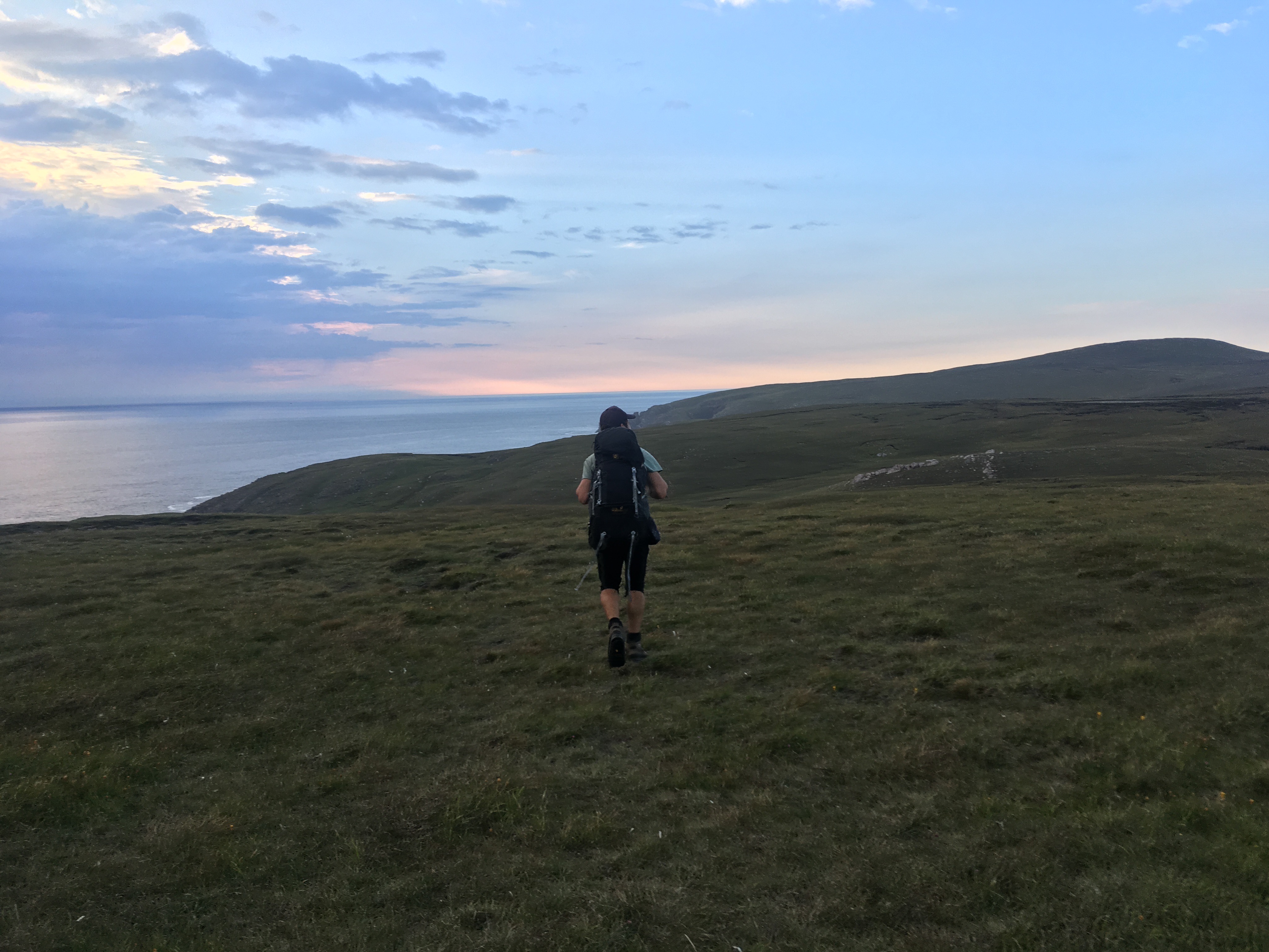
It was around this time of the hike, that we realised we must have gotten some information concerning the distance wrong. We knew the packs and the terrain slowed us down, but it couldn’t be this much. And suddenly I realized, I must have gotten kilometers mixed up with miles. And the 10 kilometers were in fact 17 kilometers. In addition to the 7 km we already hiked to Sandwood Beach. What a stupid mistake to make! Yet our sense of competition was awakened. The sun wasn’t going to set for another few hours. And we knew, if we didn’t make it to the lighthouse tonight, we were not gonna go on and all the way back in one day on the next day. So we hiked on. And on. And on…
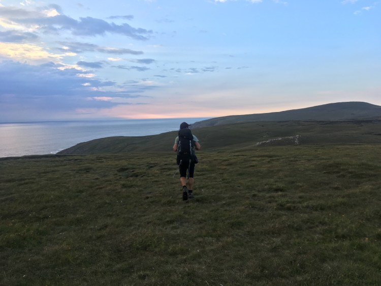
… and reached the lighthouse on Cape Wrath, Britains most north-westerly point at 10:15 pm, after some 9 hours of solid hiking and just in time for a beautiful sunset on the clifftop, where we set up camp for the night.
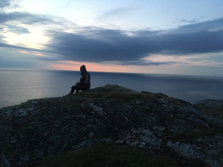
We had pasta for dinner, and tea and soup and a bit of victory-whiskey on the cliff top and enjoyed the view and set down for a well-deserved rest (which was cut short by a storm which made us afraid our tent was going to get ripped apart – Cape Wrath, I hear thy name), before we got up at 8 am the next day and hiked the 24 kilometers back out. We made it back to the car by 3 pm, exhausted, looking forward to a proper shower and a hot meal in a warm pub, but also superhappy about having made it, proud when we realized that we hiked a good 48 kilometers with fully packed backpacks in just a little bit over 24 hours, and with precious memories of a spectacularly beautiful, lonely, wild little corner of this planet.

Andrew
Wow, long hike, but a wonderful place. Shame you missed the café at Cape Wrath, it seems unlikely but it really does exist! There’s also a comfortable and interesting bothy not far from Sandwood Bay, pictures on my blog. Thanks for sharing your great pictures. Best wishes.
LikeLiked by 1 person
Claudia
Thanks for reading this post and for your comments. I will have to go back to hit the café sometime. And the bothy. And I will check out your blog too! Best, Claudia
LikeLike