A vast wasteland lies hidden between the mountains of Braunwald and Klöntal. A wasteland of rock and rubble and treacherously deep crevasses. A trail winds through this maze-like landscape that lets you experience a feeling as if you’ve landed on the moon in a fairly easy day-hike, that I hugely enjoyed.


The hike starts off at Braunwald, or if you want to skimp on elevation gain a little, up at the cableway station at Gumen (1901 meters). From there you follow the tiny trail towards Klöntal, a trail that rather steeply leads you up another 300 meters of elevation up to the Bützi (2150 meters) and then on into a high valley of super rugged and stunning karst terrain.


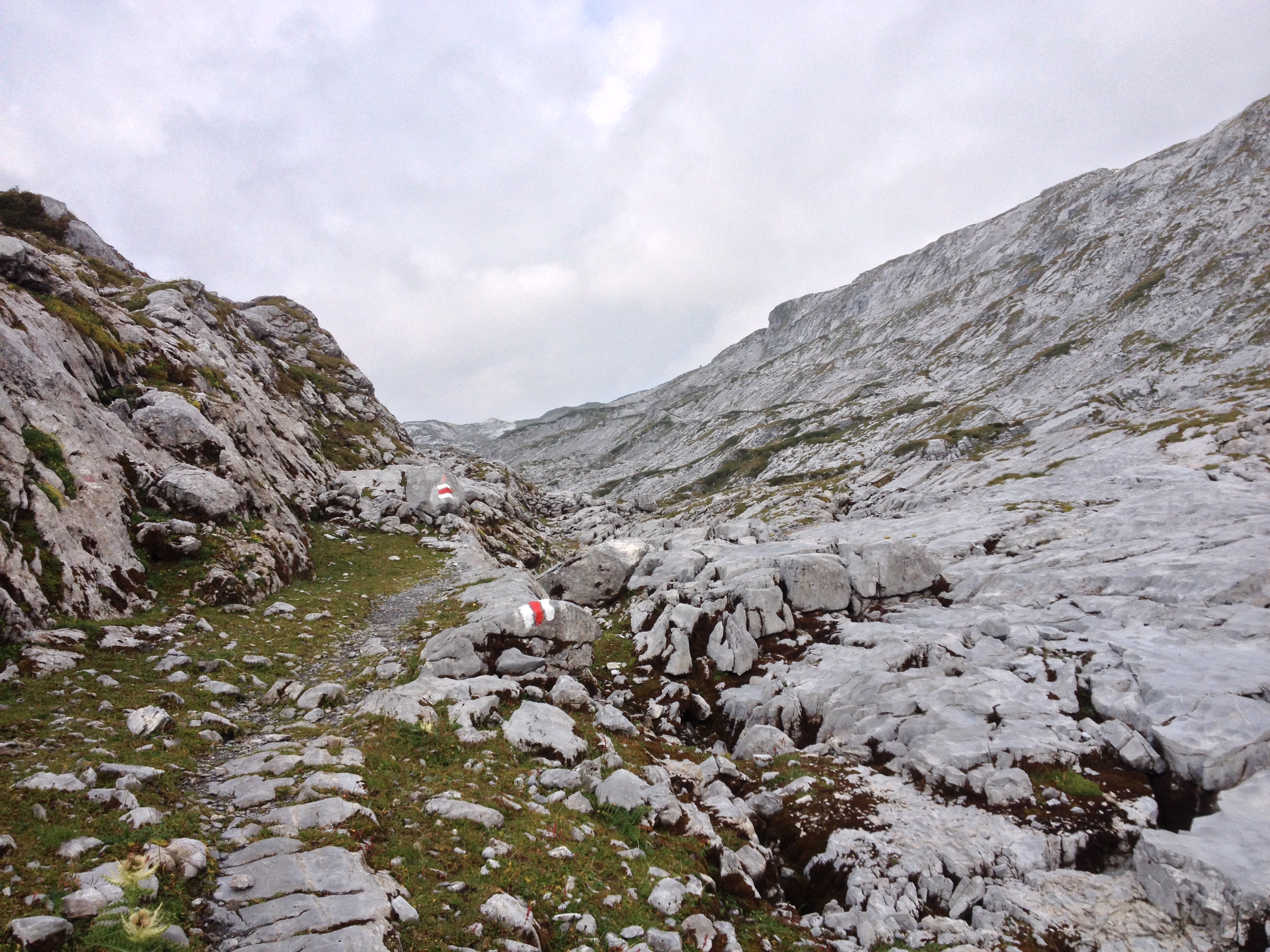
An old stories says that a long long time ago the devil used to plow this plateau with two horses of fire and thusly the deep gullies in this unique landscape were formed. At first there is still a lot of grassland and flowers to be seen, but on an on the trail leads you further into the maze of crumbling rock and deep, hidden rock crevasses, that seems to go on forever.


I took extra care to follow the re-and-white-trail signs on this route – and I wouldn’t recommend the trail when there is fog to be expected. Orientation could become a nightmare up there. Since even on my supposedly nice hiking day, clouds started to gather rather early in the day, I did not take too many breaks but kept on following the trail, to make sure to get out of the rocks, just in case the weather set in.


Luckily it stayed dry and the fog-less all the way up another little elevation gain to the Brunalpelihöchi (2273), the highest point of this little hike. From there the long way down starts, towards Chäseren and on to Klöntal (853 meters). It was 1400 meters of elevation loss with rather steep downhill hiking und it wasn’t the easiest path. Think scrambling over big rocks, think big steps, think tiny, narrow, slippery path – it took quite a toll on my knees as I had to find out to my disappointment. Yet the views were still very much worth it. And that you can round off your day with an afternoon at the beautifully serene Klöntal lake is just one more reason, why I hugely enjoyed this nice little day hike.


Information:
Start: Braunwald, Bergstation Gumen (public transport and cableway)
End: Klöntal (public transport (Postauto) available)
Route: Gumen – Bützi – Alp Ergismatt – Brunalpelihöchi – Dräckloch – Chäseren – Klöntal (Vorauen)
Duration: approx 6.5 hours (breaks not included)
Elevation gain: 300 metres up, 1400 metres down.
Highest point: Brunalpelihöchi, 2273 meters above sea level.
Map: 246 T Klausenpass und 236 T Lachen, 1: 50 000.
