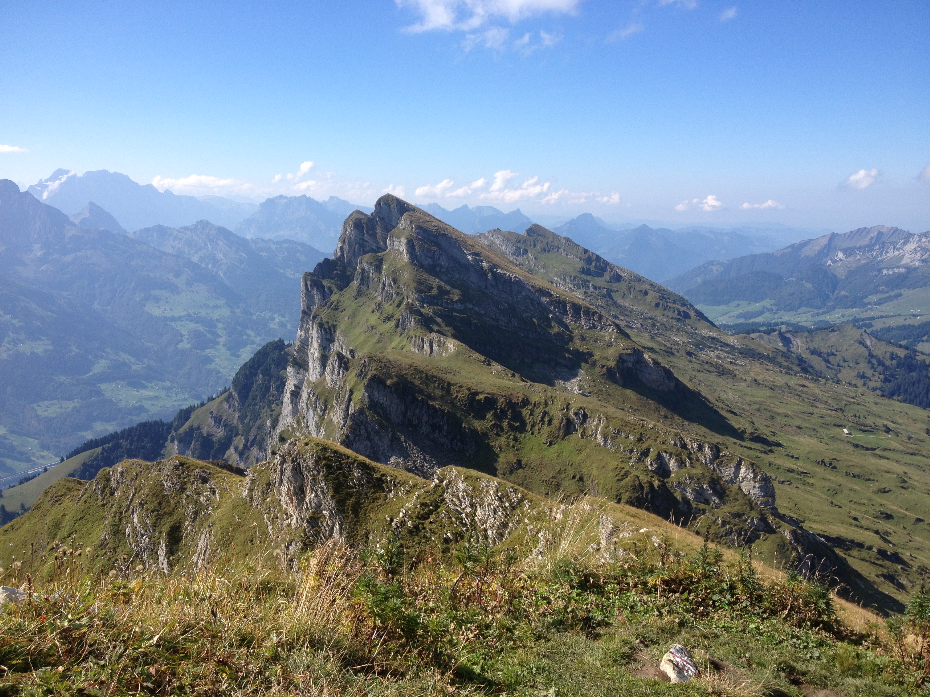
The Churfirsten are one of the most iconic mountain ranges in Switzerland. And though their south face shows spectacular cliffs towering above Walensee, the seven peaks are actually fairly easily reached via their northern side. In case of the Selun the quest is rather straight forward – the trail doesn’t even bother with switchbacks most of the time but goes straight up the back of the mountain. It is not really the most interesting trail, and the hike feels more like a regular workout. The view from the summit makes up for it though – and gets you hooked on conquering the other six peaks too.

We started our hike at a comfortable elevation of 1390 meters, having covered some ground via cableway to Alp Sellamat. From there another 800 meters of elevation seperate us from the summit of Selun, one of the seven Churfirsten. The hike starts off nice and easy leading us trough some alpine meadows and passing the junctions that would lead up Brisi and Frümsel, two other peaks of the Churfirsten.
Brisi my friend and I already know, having more or less raced up that trail a few years ago, because a thunderstorm was supposed to hit soon and we were sort of half way up already and didn’t want to turn around without having reached the summit. We made it up, barely paused for a snack and a selfie, and raced back down to presumably safer ground – said thunderstorm never hit, yet our muscles sure noticed the effort the next day.
This year we were luckier weather-wise. A super bright autumn day let us take all the time we wanted on our ways up and down. It was a strenuous hike though even without being chased by the fear of a thunderstorm, once the trail started to make its ascent towards the summit. There are some switchbacks that let you relax your legs a little bit – most of the time the trail however goes pretty much straight up the back of the mountain towards the summit. And to make it just a little meaner still, what seems to be the top from where you start off, is actually just half of the ascent. There is a second hump hiding just behind that first one.
When you are finally able to see the summit, you are more or less up there already. And the view you get is just absolutely stunning. The mountain suddenly drops down some 1500 meters; straight into the Walensee, a beautiful mountain lake. Sitting on the edge of this cliff and taking in the view of countless mountain peaks emerging before you, is super spectacular, it will make the rather workout-like trail worthwhile – and get you hooked to conquer the rest of the Churfirsten as well.


(The Churfirsten are not only popular with the hikers. So you might get lucky and see one of these crazy basejumpers take the short way down, as Jeb Corliss did in the video below, featuring some great shots of this mountain range.)
Information:
Start/End: Alp Sellamat (cable way from Alt. St. Johann, public transport available)
Route: Alp Sellamatt – Strichboden – Selun – Strichboden – Alp Sellamatt.
Duration: approx. 6 hours roundtrip (breaks not included)
Elevation gain: 815 meters up, 815 meters down.
Highest point: Selun, 2205 meters above sea level
Map: 237 T
